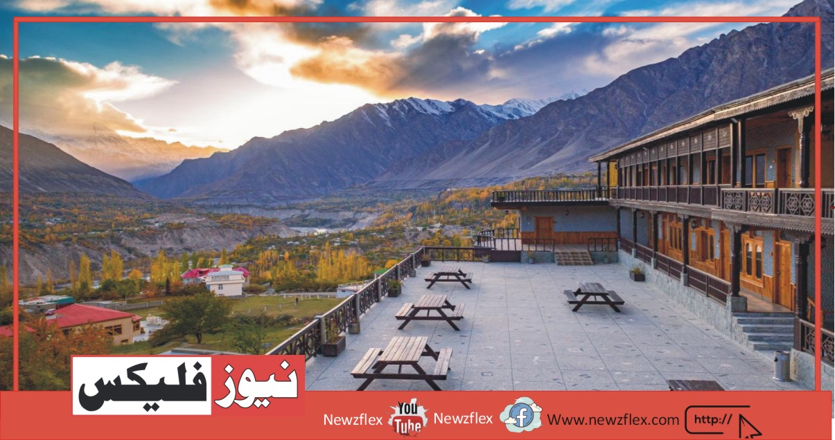
Hunza
Hunza Valley
Mountainous valley situated to the north of Hunza river in Gilgit Baltistan is referred to as Hunza valley the world Renowned Hunza valley is a heaven for tourists. The capital of Hunza is Karimabad ( Baltit ), Prince Karim agha khan is the spiritual head of the Shia Ismaili Nizari community, and Karimabad is called after him, it is surrounded by three beautiful peaks Rakaposhi,Diran, and Ultar. Hunza valley is surrounded by some of the high peaks namely Rakhaposhi, Hunza peak, Darmyani peak,ghenta SAR, ultar SAR, Bojahagur Duanasir, and lady finger peak.
Hunza valley is probably one of the most beautiful and attractive areas in northern areas. This area boasts of a number of the most spectacular scenery in the world. Many of the highest mountains in the world are located in Hunza and Gilgit. The people are exotic and varied.
Hunza River
The river cuts through the Karakoram and flows over the total length of the constructed between 1971 and 1980 Karakoram highway.
The Hunza occurs at the confluence of two rivers: The khunjerab, which from the khunjerab-pas comes in the northeast, and ghujerab from the southeast. From this time flows Hunza a kilometer long and 90 to the south by Gojal, the best part of Hunza valley orchards and fields surrounded by high mountains including the peaks Rakaposhi and ultar.
Fruit Orchids
Hunza is an agricultural city. Miles and miles of fruit orchards are seen because the tourist approaches Karimabad. Apricots are the key diet in summers and are stored throughout the winters. Some wonderful green fields with trees in them.
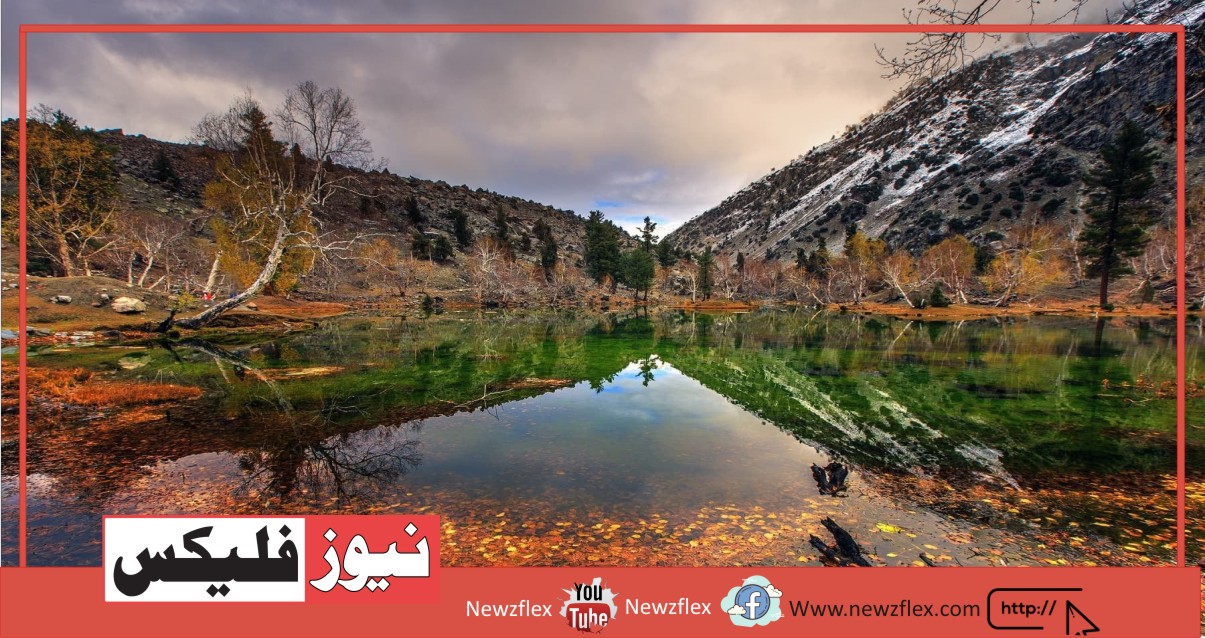
Attabad Lake
Attabad lake, Gojal, also referred to as Gojal lake], is a lake in the Gojal valley of northern Pakistan created in January 2010 by a landslide dam.
The lake was formed thanks to a large landslide at Attabad village in Gilgit-Baltistan, 9 miles (14 km) upstream (east) of Karimabad that occurred on January 4, 2010. The landslide killed twenty people and blocked the flow of the Hunza river for five months. The lake reached 13 miles (21 km) long and over 100 meters (330 ft.) comprehensive by the first week of June 2010.
Queen Victoria Monument, Karimabad, Hunza
The queen victoria monument at the top of the rock face behind Karimabad will be reached in an hour from Baltit. Take the channel path above the polo ground. Thought to be erected by Nazim khan, in Burushaski, the monument is termed malikamu shikari (ma-li-ka-mu shi-ka-RI).
Hopar Glacier
Hopar Valley is a cluster of villages around a natural bowl at a bend of bualtar glacier. Opposite hopar the white bualtar is joined by the barpu glacier. This can be a base camp for treks into the high, glacier-draped peaks called the hispar Muztagh. This valley is stuffed with natural resources and natural beauty but thanks to ignorance of state and native politicians add to its backwardness. The 12 km length of hopar glacier you’ll be able to actually hear it groan while standing at its side since it’s the fastest moving glacier in Pakistan.
Altit Fort
In Hunza, there are two old forts here, Altit and Baltit. In the village of Altit, there is located an Altit fort, and this village is about 3km from Karimabad. Altit fort is about 800 years old and it absolutely was the first residence of the Mir of Hunza now this fort is under renovation. one and a half km walk to the east takes you to the attractive village of Altit.
At the entry point of Altit, there’s a stunning garden of white apricots which is additionally known for its taste.
Baltit fort
Located at the top of a huge rocky amphitheater Baltit fort is about a 3km jeep drive from Karimabad. It is built at the highest of Karimabad The fort was built some seven hundred years ago. The doors inside were quite short and therefore the tour guide explained that it absolutely was for defensive mechanism. In 1997 it had been renovated by using mudbricks and timber so as to face up to the earthquakes. In this area, The Fort is now a museum and cultural center.
On the ground floor, there are guest rooms, kitchens, storerooms, prisons, etc. If you visit the second floor there are family apartments, reception rooms, royal court, arms depot, and guards` chambers, and on the 2nd floor, there’s a roof, from here you’ll be able to view the beautiful peak of Rakaposhi.
You have to buy tickets if you would like to go to a fort and additionally to the tickets you’ll even be charged extra if you would like to take photographs or make videos inside the fort. Opening time of fort: 9 to 1 and a couple of to 530 Entry Fee: 200Rs ticket booth is on the left side of the fort just 30 meters before reaching the fort.
Rakaposhi
It is a mountain in a Karakoram mountain range situated in a Nagar valley and is easily visible from Karim Abad and surrounding areas of Karimabad . It is the 27th highest peak in the world. Rakaposhi means “shining wall” or “ Snow-covered” its steep ice-covered peak towering above barren cliffs and terraces. Domani is another name for Rakaposhi which means “ mother of mist”.The first quick look that you can enjoy is from an area called zero point which is right on Karakoram highway where you get a magnificent view of the peak, with glacier-fed streams running down. It is ranked 12th highest in Pakistan but it is more popular for its beauty compared to its rank.
Khunjerab pass
- In the Karakorum highways, there is a high mountain pass which is known as khunjerab pass, which is the highest point at the Karakoram with 4730 meters peak.
- It is so fascinating that the first glimpse at it arouses attraction.
- The completion of the section of this road was done in 1982.
- It is thought to be the highest metaled border crossing.
- From December to April, the pass is often covered by snow due to the rainy season, in this season mud sliding is common so the pass remained closed for all vehicles other than trucks.
- Consultants were interested in the construction of the railway through this pass in 2007.
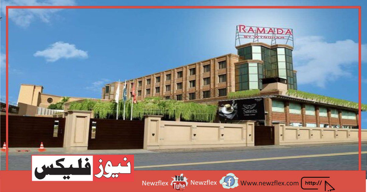
Hotels in Hunza
- Darbaar hotel
- Hunza Baltit inn
- Eagle’s Nest
Travelling
If you wanted to visit Hunza, you can g by air as well as by road. If you choose to go by air then the nearest airport is Gilgit, you can reserve your ticket from PIA because only PIA operates daily 2 flights to Gilgit, one at 6:45 am and another at 9:45 am.
If you wanted to travel by road then you can go by Bisham road which is a 12-14 hours drive from Islamabad, then from chillas to Gilgit it is an 8-9 hours drive .from here it takes 3 hours to reach Hunza
If you go by air don’t travel in the monsoon season because there is less chance of getting a flight due to bad weather. The monsoon season is from July to September.
Sost- Hunza valley
Sost is a town present in gojal valley of Hunza district, Gilgit- baltistan, Pakistan. It is the last town inside Pakistan on the Karakoram highway. It is an important town in which the customs and immigration department is present. It is also important for all cargo and passenger transport because traffic crossing the Pakistan-china border passes through this town. The border between Pakistan and china is present at khunjerab, the highest border on Earth. In Sost , a dry port is present and goods that come from the Chinese regions of kashgar and sinkiyang get custom clearance here and are transported to the commercial markets of Pakistan. This town is connected to towns like Karim Abad, Gilgit, and chilas in the south Pakistani region and is connected to towns like tashkurgan, upal, and Kashgar in the north Chinese region.
For accommodation purposes, PTDC motel is placed here and several other small hotels are also available.
For transport, the Northern areas transport corporation (NATCO) is present which connects Islamabad to Sost. Transport facility is also present between Sost and the Chinese city Taskurgan, bus service also started between Kashgar and Sost in 2006. The highest border on earth between Pakistan and china opens only between May and October. During winter, roads get blocked by snow.
Shimshal
Shimshal is a village present in the Hunza-Nagar district of Gilgit-Baltistan, Pakistan. It lies at a height of 3100m above sea level and is the highest settlement in the Hunza valley. It is a bordering village that connects China with Pakistan. Shimshal is comprised of 3800 square kilometers, there are almost 2000 inhabitants with a total of 240 households.
Shimshal has a hydroelectricity base known as over stream, which gives electricity for five months when water isn’t frozen from June to October. Non-availability of electricity is a big problem for the residents of Shimshal for the other seven months. They use different resources like kerosene oil, firewood, and gas cylinders as an alternative.
The village was inaccessible since 2003 when a new road is constructed from the Karakoram highway at passu. This non-metallic road was started in 1985 and completed in 2003 and now it takes a maximum of 3 hours to Shimshal from passu.
Tourism in Shimshal
Shimshal has its largest adventure area in the Hunza valley. Many tourist points are present in this village.
Mountains like Destaghil Sar(7,885m), Shimshal White Horn( 6,303m) Manglik Sar(6,150m), and Yazghail Sar(6000m) are catching the eyeballs of tourists for so many long time. This village is known as the “Village of mountaineers” because more than twenty mountaineers from this village have made Pakistan proud in the field of tourism.
Shimshalis use various grasslands situated several days walk for their cattle, sheep, and goats. The people of Shimshal speak wakhi language and they are also known as Wakhis. Shimshal belongs to the Ismaili Shia sect and they follow Agha khan as their 49th spiritual leader.
Nagar Valley
Nagar valley is situated in the northernmost part of Gilgit-Baltistan. It was a princely state till 1974 when it was merged with Pakistan. Until 1947, it was in a subsidiary alliance with British India and bordered the Gilgit agency to the south and Hunza valley to the north and east. Until 1974, the capital of the princely state was the town of Nagar. Nagar valley is present in the north of Pakistan.
The geography of Nagar consists of difficult mountains and it gives a lot of protection against the invading forces. The highest mountain in Nagar valley is mount Rakaposhi situated in the south of Nagar. The Karakoram highway passes Nagar and connects Pakistan with china through khunjerab pass.
The total population of Nagar is 90,000. There are two main ethnicities in Nagar- the Burushaski speakers and shina speakers. An older type of Burushaski dialect is still spoken in the valley. The third language, Bedishki is spoken in chalt Nagar.
The population belongs to the Ismaili Shia sect. Following sectarian violence in January 2005, a six-point agreement is signed between two sects to make peace in the region.
Different Villages of Nagar
These are different villages of Nagar listed below
- Chalt Valley
- Sikandarabad Valley
- Jafarabad Valley
- Nilt Valley
- Thol Valley
- Masot Valley
- Ghulmet Valley
- Yal Valley
- Pissan Valley
Golden peak
Golden peak or spantik is a mountain present in karakoram subrange of nagar valley, Gilgit-Baltistan. Its northwest has a hard route known as the “ golden pillar”.The golden peak was first climbed in 1955. The mountain is very popular with organized commercial expeditions. Many commercial expeditions have taken place such as the Aus-Pak expedition in July 2011. Another expedition named the China-Pakistan Friendship Expedition was also organized and Dr. Abdul Jabbar Bhatti was supervising this expedition.
Hunza valley
Hunza valley is a beautiful valley situated in the north of Pakistan. Hunza valley is divided into three 3 geographic subdivisions:
- Gojal valley
Upper Hunza consists of the Gojal tehsil of Hunza Nagar district
- Lower Hunza
Lower Hunza consists of the parts of the Alliabad tehsil of the Hunza-Nagar district
- Central Hunza
Central Hunza consists of the parts of the Alliabad tehsil of the Hunza-Nagar district
People of Hunza
The people of Hunza are known for their friendliness and hospitality. Hunza valley is famous for its beauty and high-top hills. There are different languages that are spoken in this valley such as Wakhi, Shina, and Burushaski. The literacy rate of Hunza valley is unbelievably high and it is almost ninety-five percent. Hunza valley is a role model for the entire of Pakistan as it has a high literacy rate and school enrollment figure. Almost every child is educated to the high school level.”
ہنزہ
وادی ہنزہ
گلگت بلتستان میں دریائے ہنزہ کے شمال میں واقع پہاڑی وادی ہنزہ وادی کے نام سے مشہور ہے- دنیا کی مشہور وادی ہنزہ سیاحوں کے لیے جنت ہے. ہنزہ کا دارالحکومت کریم آباد (بلتیت) ہے، پرنس کریم آغا خان شیعوں کے روحانی سربراہ ہیں۔ کمیونٹی اور کریم آباد کا نام ان کے نام پر رکھا گیا ہے، یہ تین خوبصورت چوٹیوں رکھاپوشی، دیران اور التر سے گھرا ہوا ہے۔ وادی ہنزہ کچھ اونچی چوٹیوں سے گھری ہوئی ہے جن میں رکھا پوشی، ہنزہ چوٹی، درمیانی چوٹی، گھنٹہ سر، التر سر، بوجہاگور دوناصر لا اور انگلی کی چوٹی شامل ہیں.
وادی ہنزہ شاید شمالی علاقہ جات کے سب سے خوبصورت اور پرکشش علاقوں میں سے ایک ہے۔ یہ علاقہ دنیا کے چند انتہائی دلکش مناظر کا حامل ہے۔ دنیا کے کئی بلند ترین پہاڑ ہنزہ اور گلگت میں واقع ہیں۔ یہاں کے لوگ غیر ملکی اور پرکشش ہیں۔
دریائے ہنزہ
یہ دریائے قراقرم کو کاٹتا ہے اور 1971 اور 1980 کے درمیان تعمیر کی گئی شاہراہ قراقرم کے ساتھ ساتھ پوری لمبائی سے بہتا ہے۔
ہنزہ دو دریاؤں کے سنگم پر واقع ہوتا ہے: خنجراب، جو خنجرابپاس سے شمال مشرق میں آتا ہے، اور غجراب جنوب مشرق سے۔ اس مقام سے ہنزہ ایک کلومیٹر لمبا اور 90 جنوب کی طرف گوجال سے بہتا ہے، وادی ہنزہ کے باغات کا سب سے اونچا حصہ اور کھیتوں کے چاروں طرف اونچے پہاڑوں بشمول راکاپوشی اور الٹر کی چوٹیاں ہیں۔
فروٹ آرکڈز
ہنزہ ایک زرعی شہر ہے۔ جیسے ہی سیاح کریم آباد کے قریب پہنچتے ہیں میلوں میلوں پھلوں کے باغات دیکھے جا سکتے ہیں۔
خوبانی گرمیوں میں اہم غذا ہے اور اسے پورے سردیوں میں ذخیرہ کیا جاتا ہے۔ ان میں درختوں کے ساتھ کچھ حیرت انگیز سبز میدان بھی پائے جاتے ہیں۔
عطا آباد جھیل
عطا آباد جھیل، گوجال، جسے گوجال جھیل کے نام سے بھی جانا جاتا ہے]، شمالی پاکستان کی وادی گوجال میں ایک جھیل ہے جو جنوری 2010 میں ایک لینڈ سلائیڈ ڈیم سے بنی تھی۔
یہ جھیل 4 جنوری 2010 کو کریم آباد سے 9 میل (14 کلومیٹر) اپ اسٹریم (مشرق) گلگت بلتستان کے گاؤں عطا آباد میں بڑے پیمانے پر لینڈ سلائیڈنگ کی وجہ سے بنی تھی۔ مٹی کے تودے گرنے سے بیس افراد ہلاک ہوئے جس کی وجہ سے دریائے ہنزہ کا بہاؤ پانچ ماہ تک بند رہا۔
جون 2010 کے پہلے ہفتے تک جھیل 13 میل (21 کلومیٹر) لمبی اور 100 میٹر (330 فٹ) سے زیادہ گہرائی تک پہنچ گئی۔
ملکہ وکٹوریہ یادگار، کریم آباد، ہنزہ
کریم آباد کے پیچھے چٹان کی چوٹی پر واقع ملکہ وکٹوریہ کی یادگار تک بالتیت سے ایک گھنٹے میں پہنچا جا سکتا ہے۔ پولو گراؤنڈ کے اوپر چینل کا راستہ لیں۔ ناظم خان کی طرف سے تعمیر کرنے کا خیال تھا، بروشاسکی میں، یادگار کو ملکامو شکاری (ما-لی-کا-مو شی-کا-ری) کہا جاتا ہے۔
ہوپر گلیشیئر
ہوپر وادی بلٹر گلیشیر کے موڑ پر قدرتی پیالے کے آس پاس دیہاتوں کا ایک جھرمٹ ہے۔ ہوپر کے بالمقابل سفید بلٹار بارپو گلیشیئر سے ملا ہوا ہے۔ یہ اونچی، گلیشیئر سے لپٹی ہوئی چوٹیوں میں جانے کے لیے ایک بیس کیمپ ہے جسے ہسپر مزتغ کہتے ہیں۔ یہ وادی قدرتی وسائل اور قدرتی حسن سے مالا مال ہے لیکن حکومت اور مقامی سیاستدانوں کی عدم توجہی کی وجہ سے اس کی پسماندگی میں مزید اضافہ ہو رہا ہے۔ ہوپر گلیشیئر کی 12 کلومیٹر لمبائی آپ اس کے کنارے کھڑے ہو کر اسے سن سکتے ہیں کیونکہ یہ پاکستان میں سب سے تیزی سے حرکت کرنے والا گلیشیئر ہے۔
التت قلعہ
ہنزہ میں یہاں دو پرانے قلعے ہیں، التیت اور بلتیت۔ التت گاؤں میں ایک قلعہ التیت واقع ہے اور یہ گاؤں کریم آباد سے تقریباً 3 کلومیٹر کے فاصلے پر ہے۔ التیت قلعہ تقریباً 800 سال پرانا ہے اور یہ ہنزہ کے میر کی پہلی رہائش گاہ تھی اور اب اس قلعے کی تزئین و آرائش جاری ہے۔ مشرق میں آدھا کلومیٹر پیدل سفر آپ کو التیت کے خوبصورت گاؤں تک لے جاتا ہے۔
التیت کے داخلی مقام پر سفید خوبانی کا ایک خوبصورت باغ ہے جو اپنے ذائقے کے لیے بھی جانا جاتا ہے۔
بلتت قلعہ
بلتت قلعہ کریم آباد سے جیپ ڈرائیو کے ذریعے تقریباً 3 کلومیٹر کے فاصلے پر پتھریلے ایمفی تھیٹر کی چوٹی پر واقع ہے۔ یہ کریم آباد کی چوٹی پر بنایا گیا ہے یہ قلعہ تقریباً سات سو سال قبل تعمیر کیا گیا تھا۔ اندر کے دروازے کافی چھوٹے تھے اور ٹور گائیڈ نے بتایا کہ یہ قلعہ کریم آباد کے لیے تھا۔ دفاعی طریقہ کار 1997 میں اس علاقے میں زلزلوں کو برداشت کرنے کے لیے مٹی کی اینٹوں اور لکڑی کے استعمال سے اس کی تزئین و آرائش کی گئی تھی، یہ قلعہ اب ایک میوزیم اور ثقافتی مرکز ہے۔ تین منزلہ عمارت پر مبنی ہے اور اس میں کل 53 کمرے ہیں- گراؤنڈ فلور میں گیسٹ رومز، کچن، سٹور رومز، جیل سیٹ وغیرہ موجود ہیں، اگر آپ دوسری منزل پر جائیں تو فیملی اپارٹمنٹس، استقبالیہ کمرے، شاہی دربار، اسلحہ ڈپو اور گارڈز موجود ہیں۔ چیمبرز، اور دوسری منزل کے بعد ایک چھت ہے، یہاں سے آپ راکاپوشی کی خوبصورت چوٹی دیکھ سکتے ہیں، اگر آپ کسی قلعے کا دورہ کرنا چاہتے ہیں تو آپ کو ٹکٹ خریدنا ہوگا اور ٹکٹوں کے علاوہ آپ سے اضافی فیس بھی لی جائے گی۔ قلعہ کے اندر تصاویر لینا یا ویڈیو بنانا چاہتے ہیں۔ قلعہ کھلنے کا وقت: 9 سے 1 اور 2 سے 530 داخلہ فیس: 200 روپے ٹکٹ آفس قلعہ تک پہنچنے سے صرف 30 میٹر کے فاصلے پر قلعہ کے بائیں جانب ہے۔
رکھپوشی
یہ قراقرم کے پہاڑی سلسلے کا ایک پہاڑ ہے جو نگر وادی میں واقع ہے اور کریم آباد کے آس پاس کے علاقوں سے بآسانی نظر آتا ہے۔ یہ دنیا کی 27ویں بلند ترین چوٹی ہے۔ راکاپوشی کا مطلب ہے ‘چمکتی ہوئی دیوار’ یا ‘برف سے ڈھکی ہوئی’ اس کی کھڑی برف۔ بنجر چٹانوں اور: چھتوں کے اوپر ڈھکی ہوئی چوٹی”. ڈومانی رکھ پوشی کا ایک اور نام ہے جس کا مطلب ہے ‘دھند کی ماں’.. پہلی جھلک جس سے آپ لطف اندوز ہو سکتے ہیں وہ زیرو پوائنٹ نامی علاقے سے ہے جو شاہراہ قراقرم پر دائیں طرف ہے چوٹی کا ایک شاندار نظارہ، جس میں گلیشیئر سے پانی کی ندیاں بہہ رہی ہیں۔ یہ پاکستان میں 12 ویں نمبر پر ہے لیکن یہ اپنی خوبصورتی کی وجہ سے اپنی درجہ بندی کے مقابلے میں زیادہ مشہور ہے۔
درہ خنجراب
قراقرم ہائی ویز میں ایک اونچا پہاڑی درہ ہے جسے خنجراب پاس کہا جاتا ہے، جو قراقرم کا سب سے اونچا مقام ہے جس کی چوٹی 4730 میٹر ہے۔ یہ اتنا مسحور ہے کہ اس کی پہلی جھلک ہی کشش پیدا کر دیتی ہے۔ اس سڑک کے حصے کی تکمیل 1982 میں ہوئی تھی۔ یہ سب سے زیادہ دھاتی سرحدی کراسنگ سمجھا جاتا ہے۔
دسمبر سے اپریل کے دوران بارش کے موسم کی وجہ سے یہ اکثر برف سے ڈھک جاتا ہے، اس موسم میں کیچڑ پھسلنا عام بات ہے اس لیے یہ پاس ٹرکوں کے علاوہ تمام گاڑیوں کے لیے بند رہتا ہے- کنسلٹنٹس نے 2007 میں یہاں ریلوے کی تعمیر میں دلچسپی لی تھی۔
ہنزہ میں ہوٹل
نمبر1:دربار ہوٹل
نمبر2:ہنزا بالٹیٹ ان
نمبر3:ایگل کا گھوںسلا
سفر
اگر آپ ہنزا جانا چاہتے ہیں تو ، آپ بائی ائیر کے ساتھ ساتھ سڑک کے ذریعہ بھی جی سکتے ہیں۔ اگر آپ بائی ائیر کے ذریعے جانے کا انتخاب کرتے ہیں تو قریب ترین ہوائی اڈہ گلگٹ ہے ، آپ اپنا ٹکٹ پی آئی اے سے محفوظ کرسکتے ہیں کیونکہ صرف پی آئی اے روزانہ 2 پروازیں گلگٹ کے لئے چلاتا ہے ، ایک۔ صبح 6: 45 بجے اور دوسرا صبح 9: 45 بجے۔
اگر آپ سڑک کے ذریعے سفر کرنا چاہتے ہیں تو آپ بشام روڈ کے ذریعہ جاسکتے ہیں جو اسلام آباد سے 12-14 گھنٹے کی دوری پر ہے ، پھر چلاس سے گلگت تک یہ 8-9 گھنٹے کی ڈرائیو ہے۔ یہاں ہنزا پہنچنے میں 3 گھنٹے لگتے ہیں۔
اگر آپ بائی ائیر کے ذریعہ جاتے ہیں تو مون سون کے موسم میں سفر نہ کریں کیونکہ خراب موسم کی وجہ سے پرواز کرنے کا کم امکان موجود ہے ۔منسون کا موسم جولائی سے ستمبر تک ہے۔
سوسٹ- ہنزا ویلی
سوسٹ ایک قصبہ ہے جو ضلع ہنزا ضلع ، گلگت- بلتستان ، پاکستان کے گوجل میں موجود ہے۔ یہ کراکورام شاہراہ پر پاکستان کے اندر آخری شہر ہے۔ یہ ایک اہم شہر ہے جس میں کسٹم اور امیگریشن ڈیپارٹمنٹ موجود ہے۔ یہ تمام کارگو اور مسافروں کی نقل و حمل کے لئے بھی اہم ہے کیونکہ پاکستان چین کی سرحد عبور کرنے والے ٹریفک اس شہر سے گزرتا ہے۔ پاکستان اور چین کے مابین سرحد کھونجیراب میں موجود ہے ، جو زمین کی سب سے اونچی سرحد ہے۔ سوسٹ میں ، خشک بندرگاہ موجود ہے اور سامان جو کاشگر اور سنکیانگ کے چینی علاقوں سے آتا ہے یہاں کسٹم کلیئرنس ملتا ہے اور اسے پاکستان کی تجارتی منڈیوں میں منتقل کیا جاتا ہے۔ یہ قصبہ پاکستانی خطے میں جنوب میں کریم آباد ، گلگٹ اور چیلا جیسے قصبوں سے جڑا ہوا ہے اور چینی خطے میں شمال میں شمال میں واقع تاشکورگن ، اپل اور کاشگر جیسے قصبوں سے جڑا ہوا ہے۔
رہائش کے مقاصد کے لئے ، پی ٹی ڈی سی موٹل یہاں رکھا گیا ہے اور کئی دوسرے چھوٹے ہوٹل بھی دستیاب ہیں۔
نقل و حمل کے لئے ، ناردرن ایریاز ٹرانسپورٹ کارپوریشن (این اے ٹی سی او) موجود ہے جو اسلام آباد کو ایس او ایس ٹی سے جوڑتا ہے۔ سوسٹ اور چینی سٹی ٹاسکورگن کے مابین نقل و حمل کی سہولت بھی موجود ہے ، کاشگر اور سوسٹ کے مابین بس سروس کا آغاز 2006 میں بھی ہوا تھا۔ پاکستان اور چین کے مابین زمین کی سب سے اونچی سرحد صرف مئی اور اکتوبر کے درمیان کھلی ہوئی ہے۔ سردیوں کے دوران ، سڑکیں برف سے مسدود ہوجاتی ہیں
شمشل
شمشل ایک گاؤں ہے جو ہنزا ناگر ضلع گلگت بلتستان ، پاکستان میں موجود ہے۔ یہ سطح کی سطح سے 3100 میٹر اونچائی پر ہے اور وادی ہنزا میں سب سے زیادہ آبادکاری ہے۔ یہ ایک سرحدی گاؤں ہے جو چین کو پاکستان سے جوڑتا ہے۔ شمشل 3800 مربع کلومیٹر پر مشتمل ہے ، یہاں تقریبا 2000 باشندے ہیں جن میں کل 240 گھرانے ہیں۔
شمشل کے پاس ایک ہائیڈرو بجلی کا اڈہ ہے جسے اوڈور اسٹریم کہا جاتا ہے ، جو پانچ ماہ تک بجلی دیتا ہے جب جون سے اکتوبر تک پانی منجمد نہیں ہوتا ہے۔ باقی سات ماہ تک شمشل کے رہائشیوں کے لئے بجلی کی عدم دستیابی ایک بہت بڑا مسئلہ ہے۔ وہ مختلف وسائل جیسے مٹی کے تیل ، لکڑی اور گیس سلنڈروں کو متبادل کے طور پر استعمال کرتے ہیں۔
یہ گاؤں 2003 کے بعد سے ناقابل رسائی تھا جب پاسو میں کراکورام ہائی وے سے ایک نئی سڑک تعمیر کی گئی تھی۔ یہ غیر دھاتی سڑک 1985 میں شروع کی گئی تھی اور 2003 میں مکمل ہوئی تھی اور اب پاسو سے شمشل میں زیادہ سے زیادہ 3 گھنٹے لگتے ہیں۔
شمشل میں سیاحت
شمشل کا وادی ہنزہ میں اس کا سب سے بڑا ایڈونچر ایریا ہے۔ اس گاؤں میں بہت سارے سیاحتی مقامات موجود ہیں۔
ڈسٹگھل سار (7،885 میٹر) ، شمشل وائٹ ہورن (6،303 میٹر) منگلک سار (6،150 میٹر) اور یزہیل سار (6000 میٹر) جیسے پہاڑ اتنے عرصے سے سیاحوں کی آنکھوں کی بالیاں پکڑ رہے ہیں۔ اس گاؤں کو “گاؤں کوہ پیما” کے نام سے جانا جاتا ہے کیونکہ اس گاؤں کے بیس سے زیادہ کوہ پیما نے سیاحت کے میدان میں پاکستان کو فخر محسوس کیا ہے۔
شمشالیوں نے اپنی بلیوں ، بھیڑوں اور بکروں کے لئے کئی دن واک پر واقع مختلف گھاس کی زمینیں استعمال کیں۔ شمشل کے لوگ واکی زبان بولتے ہیں اور وہ واخیس کے نام سے بھی جانا جاتا ہے۔ شمشالیوں کا تعلق اسماعیلی شیعہ فرقے سے ہے اور وہ اپنے 49 ویں روحانی پیشوا کے طور پر آغا خان کی پیروی کرتے ہیں۔
وادی نگر
وادی نگر گلگت بلتستان کے بیشتر حصے میں واقع ہے۔ یہ 1974 تک ایک شاہی ریاست تھی جب اسے پاکستان میں ضم کیا گیا تھا۔ 1947 تک ، یہ برطانوی ہندوستان کے ساتھ ماتحت اتحاد میں تھا اور اس نے شمال اور مشرق میں جنوب اور وادی ہنزا کی طرف گلگت ایجنسی سے سرحد سے جڑا تھا۔ 1974 تک ، شاہی ریاست کا دارالحکومت نگر شہر تھا۔ وادی نگر پاکستان کے شمال میں موجود ہے۔
نگر کا جغرافیہ مشکل پہاڑوں پر مشتمل ہے اور یہ حملہ آور قوتوں کے خلاف بہت تحفظ فراہم کرتا ہے۔ وادی نگر کا سب سے اونچا پہاڑ نگر کے جنوب میں واقع ماؤنٹ راکاپوشی ہے۔ کراکورام ہائی وے نگر سے گزرتی ہے اور خنجراب پاس کے ذریعے پاکستان کو چین سے جوڑتی ہے۔
نگر کی کل آبادی 90،000 ہے۔ نگر میں دو اہم نسلیں ہیں- بروشکی بولنے والے اور شینا اسپیکر۔ ایک پرانی قسم کی برشاسکی بولی ابھی بھی وادی میں بولی جاتی ہے۔ تیسری زبان ، بیڈشکی چلٹ نگر میں بولی جاتی ہے۔
آبادی اسماعیلی شیعہ فرقے سے تعلق رکھتی ہے۔ جنوری 2005 میں فرقہ وارانہ ویلیوینس کی پیروی کرتے ہوئے ، خطے میں امن قائم کرنے کے لئے دو فرقوں کے مابین چھ نکاتی معاہدے پر دستخط کیے گئے ہیں۔
نگر کے مختلف دیہات
یہ ذیل میں درج نگر کے مختلف دیہات ہیں
نمبر1:چلٹ ویلی
نمبر2:وادی سکندر آباد
نمبر3:وادی جعر آباد
نمبر4:نیلٹ ویلی
نمبر5:تھول ویلی
نمبر6:مسوٹ ویلی
نمبر7:گلمیٹ ویلی
نمبر8:یل ویلی
نمبر9:وادی پیسان
سنہری چوٹی
گولڈن چوٹی یا سپانٹک ایک پہاڑ ہے جو گلگت بلتستان کی وادی نگر کے قراقرم سبرینج میں موجود ہے۔ اس کے شمال مغرب میں ایک مشکل راستہ ہے جسے ‘سنہری ستون’ کہا جاتا ہے۔ سنہری چوٹی کو پہلی بار 1955 میں سر کیا گیا تھا۔ یہ پہاڑ منظم تجارتی مہمات میں بہت مشہور ہے۔ کئی تجارتی مہمات کی گئی ہیں جیسا کہ جولائی 2011 میں اوس پاک مہم۔ ایک اور مہم جس کا نام چائنا پاکستان فرینڈ شپ ایکسپیڈیشن تھا اس کا بھی انعقاد کیا گیا اور ڈاکٹر عبدالجبار بھٹی اس مہم کی نگرانی کر رہے تھے۔
وادی ہنزہ
وادی ہنزہ پاکستان کے شمال میں واقع ایک خوبصورت وادی ہے۔ وادی ہنزہ کو تین جغرافیائی ذیلی تقسیموں میں تقسیم کیا گیا ہے۔
نمبر1:وادی گوجال
بالائی ہنزہ ضلع ہنزہ نگر کی تحصیل گوجال پر مشتمل ہے۔
نمبر2:لوئر ہنزہ
زیریں ہنزہ ضلع ہنزہ نگر کی تحصیل علی آباد کے حصوں پر مشتمل ہے۔
نمبر3:وسطی ہنزہ
وسطی ہنزہ ضلع ہنزہ نگر کی تحصیل علی آباد کے حصوں پر مشتمل ہے۔
ہنزہ کے لوگ
ہنزہ کے لوگ اپنی دوستی اور مہمان نوازی کے لیے جانے جاتے ہیں۔ وادی ہنزہ اپنی خوبصورتی اور اونچی چوٹیوں کی وجہ سے مشہور ہے۔ اس وادی میں مختلف زبانیں بولی جاتی ہیں جیسے واکھی، شینا اور بروشاسکی۔ وادی ہنزہ کی شرح خواندگی ناقابل یقین حد تک زیادہ ہے اور یہ تقریباً پچانوے فیصد ہے۔ ہنزہ وادی پورے پاکستان کے لیے ایک رول ماڈل ہے کیونکہ اس میں خواندگی کی شرح اور اسکولوں میں داخلے کی تعداد بہت زیادہ ہے۔ تقریباً ہر بچہ ہائی اسکول کی سطح تک تعلیم یافتہ ہے۔