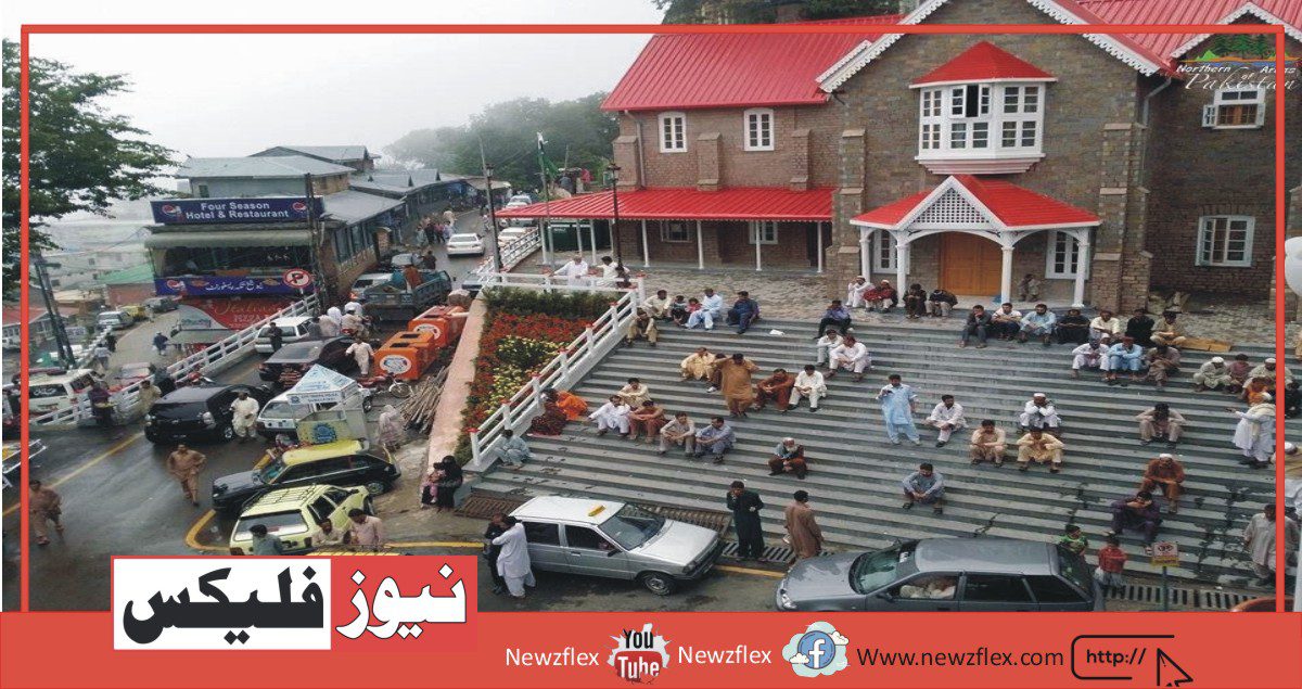
MURREE
Murree is a popular hill station, summer resort, famous tourist attraction, and administrative center of Murree Tehsil Pakistan. It is located in the Pir Panjal Range, nearly 60 kilometers away from the North of Islamabad and Rawalpindi.
Murree is most loved and noticed for its pleasant summers and snowy winters and the various local seasonal delicacies. It is one of the most popular destinations for vacations and visits. Murree resides at an altitude of nearly 7500 ft. Murree was the summer capital of the British Raj in the Punjab Province.
If we talk about the accessibility to Murree, there are basically two main roads that lead to Murree; the old Murree Road (Highway) and the new ISB-Murree Expressway, as shown in the pictures below.
Expressway
The whole tehsil of Murree consists of a number of popular places, each with its own specialty and a unique tourist attraction. Further described is the one-by-one detailed analysis of each of these locations, based on the places which come first on our route to Murree.
GHORA GALI
Ghora Gali is one of the tourist mountain resort towns of the Galyat area of Northern Pakistan. It has an elevation of nearly 1690 meters and is located in the northeastern top of the Punjab Province. There are many attractions in Ghora Gali including the Tomb of Doormat Khan, a leader of the Dhond Abbasi tribe, as well as Lawrence College, which was established initially as an asylum for orphans of British troops killed in the wars. Murree brewery too was set up here in 1860 to produce beer for the British troops.
Lawrence College
Ghora Gali is also equipped with an 1100m long chairlift which has a route from Ghora Gali to Pindi Point. The area is rich with pine trees and tropical vegetation with exquisite flora and fauna to be viewed and experienced.
Ghora Gali is also famous for its local delicious “Pakoray” and horse rides. Horse riding has become a major recreation in this city with time. During visits, it is pertinent for one to experience this thrill and unique experience. Many people choose horse rides after getting tired from long walks.
KULDANA
Situated at 7500 feet above sea level and spreading across an area of 6 square kilometers, Kuldana is a part of the famous Murree hills.
Kuldana is a place in Punjab Province with a very small population located there. Upper Topa, Lower Topa, and Murree are some of the nearby places in Kuldana.
Kuldana is covered with dense pine forests and vegetation and is aligned with the Murree-Nathiagali road starting from the Sunny Bank and ending at Kali Mitti.
MALL ROAD
Mall Road Murree is a popular tourist attraction. It is basically a street with various shops consisting of popular souvenirs, hand-crafted artifacts, dry fruits, and popular restaurants serving mouth-watering dishes, most noticeably fish and chicken karahis. Apart from that, it’s one end has the General Post Office on it followed by numerous hotels and rest houses to facilitate the tourists with the conform of affordable and luxurious rooms.
KASHMIR POINT
Kashmir Point is on a 15 minutes walk from the GPO at a total distance of one km. You will also go through Cadet College Murree which passes through the Murree Residence area. Kashmir Point is a beautiful place. The area is surrounded by the beautiful Kashmir Mountains and lush green trees. It is the most crowded area of Murree because the rush of mall road also comes to Kashmir Point. As of now, there are various food courts and shops being constructed to cater to the rising tourist attraction in this area. Mobile signal coverage, lodgings, and medical facilities are not a problem in this area. Sights of new buildings being constructed are now very common.
PINDI POINT
Pindi point is one of the first spots to visit in Murree. Located at a 15 minutes walk from Mall Road, it’s a preferred tourist attraction. Pindi point features a beautiful view of mountains and eye-soothing greenery. the reason it’s called Pindi point is that one can see the full of Pindi from this time. The view is breathtakingly beautiful and is a quite common place for a good photography session.
There is a 1.5 km chairlift from Pindi Point to Bansara providing an excellent view along the way with tall pine trees and luxurious green vegetation. Pindi point is well equipped with cafes and playgrounds for children further nearly as good rest homes and mobile network facilities.
BARIAN
Barian is located on the Punjab Border and also the North West Frontier Province. it’s a section of the Circle Bakote region located on the Himalayas foothills. The Union Council of Palak starts in this region. Barian is found quite near Murree and was the Summer Capital of Punjab in the British Raj period.
CHANGALA TOP
Changla Gali is one of the tourist mountain resort (hill station) towns in the Galyat area of Pakistan. it’s an altitude of 2559metres. During British rule, it was the headquarters of the Northern Command School of Musketry.
Changla is found in Seer Gharbi which is a union council of the Abbottabad District. it’s located 16 kilometers north of the more famous Galyat town of Murree in Rawalpindi District.
AYUBIA
Ayubia park is a popular tourist attraction situated in the Abbottabad District within the KPK province of northern Pakistan. Ayubia was named after the second President of Pakistan, marshal Ayub Khan.
Ayubia is dense with vegetation of coniferous forests and pine trees with a powerful elevation of 8000 feet above sea level. Thandiani, Nathiagali, Ayubia, and Khansapur are some areas surrounding Ayubia. The park gradually has been developed as a resort complex from a mixture of 4 mini resorts of Khaira Gali, Khansapur, and Ghora Gali.
The area is fully equipped with all possible facilities for telecommunication and transportation. The weather is cold and pleasant in summers but very harsh in winters and therefore the extensive snow causes problems for the inmates of this area.
NATHIAGALI
Nathia Gali is a mountain resort town located in Hazara KPK Pakistan. it’s an extension of the Galiyat range which is understood for its ample hill stations and is closely interrelated.
Nathiagali is understood for its beautiful scenic beauty, serene surroundings, pleasant hiking tracks, and weather. The greater altitude contributes to cooler weather situated at 34 kilometers at one hour’s dispel from both Murree and Abbottabad and takes 2 hours to achieve from Islamabad. it’s a superb place to retreat for quality time and meditation. The greenery and think-about of this area are sort of like an author’s description of a secluded fairyland world.
Mobile network signals aren’t a difficulty aside from some patches; lodgings facilities too are available together with medical facilities.
LOWER TOPA
Lower Topa is yet another popular tourist spot, with a decent snowy winter and pleasant summer seasons. the area boasts of its pride, i.e. “PAF Public School Lower Topa” which is placed on a mountain hilltop near Patriata. This institution is understood because an elite air force institution with the only aim of grooming young cadets into future combat pilots. per annum various candidates compete to secure admission during this prestigious institute.
The Lower Topa viewpoint is a popular destination in this area. Tourists enjoy an excellent view of the mountains and therefore the greenery while sipping on a hot mug of local coffee or tea.
PATRIATA
Patriata also referred to as “New Murree” is a hill station on the northern side of Punjab and is situated 15 kilometers northeast of the famous Murree hills. Patriata is situated in “Murree Tehsil”, which is a sub-division of the Rawalpindi district. It’s at an altitude of about 7500 feet above sea level. This provides Patriata with one of the foremost pleasant and funky weathers in the country and it is not uncommon to work out people rush for Patriata to spend some days vacation amongst the blistering summer heat.
Tourist attractions include the chair lift and cable car recreational facilities which take the tourists on an extended journey of serenity and peace. The chairlift gives the sensation of gliding through the clouds with a silent demeanor. It’s indeed a requirement experience event. The Patriata area is dense with rainforest vegetation and is understood to host monkeys and leopards in its dense forests. Sightings have often been reported. Roads during this region are developed to excellence and therefore the tourists can enjoy a simple and smooth drive round the area. Facilities like telecommunication and lodgings also are available easily.
Following is a view from the chairlift at Patriata.
GHARIYAL
Ghariyal is understood because of the “army residential” area. This is often where the army personnel comes to measure with their families. There’s also a military unit situated here. There are attractive army huts constructed here for the army personnel and their families. Military exercises are often conducted here in addition. Suffice it to mention that the base camp of Murree is in Ghariyal.
BHURBAN
Bhurban is a community named after a close-by forest. It’s one of the supreme tourist attractions of the northern region of Pakistan. Pearl Continental Bhurban is a major development with reference to tourism and tourist facilities in this area and is a popular destination for honeymooners and family vacationers. it’s approximately 9 kilometers far from Murree hills.
Bhurban is situated between Kashmir Road and Murree at a powerful height of 6000 feet. However, because of the development of the Islamabad-Murree expressway, it’s accessible by road in mere 45 minutes from Islamabad.
Bhurban is known mutually of the foremost picturesque places within the country. The green valleys and hills and natural beauty are mind-blowing and really beautiful. People trying to find solitude and serenity are best advised to go to this area and explore its unique flora and fauna and therefore the rare species of birds and vegetation found in this area. Since PC Bhurban many other hotels are constructed here still to cater to a lower lodging cost for people of the social class.
The traditional Bhurban families consist of Sheraals, Saidwals, Mumdals, Tapyal and Janyals, and Jogyals.
مری
مری ایک مشہور ہل اسٹیشن، موسم گرما کی تفریحی جگہ، مشہور سیاحوں کی توجہ اور مری تحصیل پاکستان کا انتظامی مرکز ہے۔ یہ اسلام آباد اور راولپنڈی کے شمال کی طرف تقریباً 60 کلومیٹر دور پیر پنجال کے سلسلے میں واقع ہے۔
مری اپنی خوشگوار گرمیوں اور برفانی سردیوں اور مختلف مقامی موسمی پکوانوں کی وجہ سے سب سے زیادہ پسند کیا جاتا ہے۔ یہ تعطیلات اور دوروں کے لیے مقبول ترین مقامات میں سے ایک ہے۔ مری تقریباً 7500 فٹ کی بلندی پر رہتا ہے۔ مری صوبہ پنجاب میں برطانوی راج کا گرمائی دارالحکومت تھا۔
اگر ہم مری تک رسائی کی بات کریں تو بنیادی طور پر دو اہم سڑکیں ہیں جو مری تک جاتی ہیں۔ پرانی مری روڈ (ہائی وے) اور نیا آئی ایس بی-مری ایکسپریس وے، جیسا کہ ذیل کی تصویروں میں دکھایا گیا ہے۔
ایکسپریس وے
مری کی پوری تحصیل متعدد مشہور مقامات پر مشتمل ہے، جن میں سے ہر ایک کی اپنی خاصیت اور سیاحوں کی توجہ کا ایک منفرد مقام ہے۔ مزید بیان کیا گیا ہے ان مقامات میں سے ہر ایک کا تفصیلی تجزیہ، ان جگہوں کی بنیاد پر جو ہمارے مری کے راستے پر پہلے آتے ہیں۔
گھوڑہ گلی
گھوڑہ گلی شمالی پاکستان کے گلیات علاقے کے سیاحتی پہاڑی تفریحی شہروں میں سے ایک ہے۔ اس کی بلندی تقریباً 1690 میٹر ہے اور یہ صوبہ پنجاب کے شمال مشرقی چوٹی میں واقع ہے۔ گھوڑا گلی میں بہت سے پرکشش مقامات ہیں جن میں دھونڈ عباسی قبیلے کے رہنما دومت خان کا مقبرہ، نیز لارنس کالج، جو ابتدائی طور پر جنگوں میں ہلاک ہونے والے برطانوی فوجیوں کے یتیم بچوں کے لیے پناہ گاہ کے طور پر قائم کیا گیا تھا۔ مری بریوری بھی یہاں 1860 میں برطانوی فوجیوں کے لیے بیئر بنانے کے لیے قائم کی گئی تھی۔
لارنس کالج
گھوڑا گلی ایک 1100 میٹر لمبی چیئر لفٹ سے بھی لیس ہے جس کا گھوڑا گلی سے پنڈی پوائنٹ تک کا راستہ ہے۔ یہ علاقہ دیودار کے درختوں اور اشنکٹبندیی پودوں سے مالا مال ہے جس میں شاندار نباتات اور حیوانات دیکھنے اور تجربہ کرنے کے لیے ہیں۔
گھوڑا گلی اپنے مقامی لذیذ ‘پکوڑے’ اور گھوڑے کی سواری کے لیے بھی مشہور ہے۔ وقت کے ساتھ ساتھ اس شہر میں گھڑ سواری ایک اہم تفریح بن گئی ہے۔ دوروں کے دوران کسی کے لیے اس سنسنی اور انوکھے تجربے کا تجربہ کرنا مناسب ہے۔ بہت سے لوگ لمبی سیر سے تھک جانے کے بعد گھوڑے کی سواری کا انتخاب کرتے ہیں۔
کلدانا۔
سطح سمندر سے 7500 فٹ کی بلندی پر واقع اور 6 مربع کلومیٹر کے رقبے پر پھیلا کلڈانہ مری کی مشہور پہاڑیوں کا ایک حصہ ہے۔ کلڈانہ صوبہ پنجاب کا ایک مقام ہے جس کی آبادی بہت کم ہے۔ اپر ٹوپا، لوئر ٹوپا اور مری کلڈانہ کے کچھ قریبی مقامات ہیں۔
کلڈانا دیودار کے گھنے جنگلات اور پودوں سے ڈھکا ہوا ہے اور یہ مری-نتھیاگلی سڑک کے ساتھ منسلک ہے جو سنی کنارے سے شروع ہو کر کالی مٹی پر ختم ہوتی ہے۔
مال روڈ
مال روڈ مری سیاحوں کی توجہ کا مرکز ہے۔ یہ بنیادی طور پر ایک گلی ہے جس میں مختلف دکانیں ہیں جن میں مشہور تحائف، ہاتھ سے تیار کردہ نمونے، خشک میوہ جات اور منہ میں پانی بھرنے والے پکوان پیش کرنے والے مشہور ریستوراں ہیں، خاص طور پر مچھلی اور چکن کراہی۔ اس کے علاوہ، اس کے ایک سرے پر جنرل پوسٹ آفس ہے جس کے بعد سیاحوں کو سستی اور پرتعیش کمروں کی سہولت فراہم کرنے کے لیے متعدد ہوٹل اور ریسٹ ہاؤس ہیں۔
کشمیر پوائنٹ
کشمیر پوائنٹ جی پی او سے 15 منٹ کی پیدل سفر پر کل ایک کلومیٹر کے فاصلے پر ہے۔ آپ کیڈٹ کالج مری سے بھی جائیں گے جو مری کے رہائشی علاقے سے گزرتا ہے۔ کشمیر پوائنٹ ایک خوبصورت جگہ ہے۔ یہ علاقہ کشمیر کے خوبصورت پہاڑوں اور سرسبز و شاداب درختوں سے گھرا ہوا ہے۔ یہ مری کا سب سے زیادہ رش والا علاقہ ہے کیونکہ مال روڈ کا رش کشمیر پوائنٹ پر بھی آتا ہے۔ فی الحال اس علاقے میں سیاحوں کی بڑھتی ہوئی توجہ کو پورا کرنے کے لیے مختلف فوڈ کورٹس اور دکانیں تعمیر کی جا رہی ہیں۔ اس علاقے میں موبائل سگنل کوریج، رہائش اور طبی سہولیات کوئی مسئلہ نہیں ہے۔ نئی عمارتوں کی تعمیر کا منظر اب بہت عام ہے۔
پنڈی پوائنٹ
پنڈی پوائنٹ مری میں دیکھنے کے لیے پہلے مقامات میں سے ایک ہے۔ مال روڈ سے 15 منٹ کی پیدل سفر پر واقع یہ سیاحوں کی توجہ کا مرکز ہے۔ پنڈی پوائنٹ میں پہاڑوں کا خوبصورت نظارہ اور آنکھوں کو سکون بخشنے والی سبزہ ہے۔ اسے پنڈی پوائنٹ کہنے کی وجہ یہ ہے کہ اس پوائنٹ سے پورا پنڈی دیکھا جاسکتا ہے۔ یہ منظر حیرت انگیز طور پر خوبصورت ہے اور فوٹو گرافی کے اچھے سیشن کے لیے ایک بہت ہی عام جگہ ہے۔
پنڈی پوائنٹ سے بنسارا تک 1.5 کلومیٹر کی چیئر لفٹ ہے جو راستے میں دیودار کے لمبے درختوں اور سرسبز و شاداب پودوں کے ساتھ بہترین نظارہ فراہم کرتی ہے۔ پنڈی پوائنٹ بچوں کے لیے کیفے اور کھیل کے میدانوں کے ساتھ ساتھ اچھے ریسٹ ہومز اور موبائل نیٹ ورک کی سہولیات سے لیس ہے۔
بارین
باریان پنجاب کی سرحد اور شمال مغربی سرحدی صوبے پر واقع ہے۔ یہ ہمالیہ کے دامن پر واقع سرکل باکوٹ کے علاقے کا ایک حصہ ہے۔ پالک کی یونین کونسل اسی علاقے سے شروع ہوتی ہے۔ باریان مری کے بالکل قریب واقع ہے اور برطانوی راج دور میں پنجاب کا دارالحکومت تھا۔
چنگالہ ٹاپ
چنگلہ گلی پاکستان کے گلیات علاقے کے سیاحتی پہاڑی ریزورٹ (ہل اسٹیشن) شہروں میں سے ایک ہے۔ اس کی اونچائی 2559 میٹر ہے۔ برطانوی دور حکومت میں یہ ناردرن کمانڈ سکول آف مسکیٹری کا ہیڈ کوارٹر تھا۔
چانگلہ سیر غربی میں واقع ہے جو ضلع ایبٹ آباد کی ایک یونین کونسل ہے۔ یہ ضلع راولپنڈی میں مری کے مشہور گلیات قصبے سے 16 کلومیٹر شمال میں واقع ہے۔
ایوبیہ
ایوبیہ نیشنل پارک شمالی پاکستان کے صوبہ کے پی کے کے ضلع ایبٹ آباد میں واقع ایک مشہور سیاحوں کی توجہ کا مرکز ہے۔ ایوبیہ کا نام پاکستان کے دوسرے صدر فیلڈ مارشل ایوب خان کے نام پر رکھا گیا تھا۔ ایوبیہ سطح سمندر سے 8000 فٹ کی متاثر کن بلندی کے ساتھ مخروطی جنگلات اور دیودار کے درختوں کی پودوں کے ساتھ گھنا ہے۔
ٹھنڈیانی، نتھیاگلی، ایوبیہ اور خانساپور ایوبیہ کے آس پاس کے چند علاقے ہیں۔ پارک کو بتدریج چار منی ریزورٹس خیرہ گلی، خانسا پور اور گھوڑا گلی کے مجموعے سے ایک ریزورٹ کمپلیکس کے طور پر تیار کیا گیا ہے۔
یہ علاقہ ٹیلی کمیونیکیشن اور ٹرانسپورٹیشن کی تمام ممکنہ سہولیات سے پوری طرح لیس ہے۔ گرمیوں میں موسم سرد اور خوشگوار ہوتا ہے لیکن سردیوں میں بہت سخت اور وسیع برفباری اس علاقے کے قیدیوں کے لیے مشکلات کا باعث بنتی ہے۔
نتھیاگلی
نتھیا گلی ایک پہاڑی تفریحی شہر ہے جو ہزارہ کے پی کے پاکستان میں واقع ہے۔ یہ گلیات رینج کی توسیع ہے جو اپنے کافی پہاڑی مقامات کے لیے جانا جاتا ہے اور اس کا آپس میں گہرا تعلق ہے۔
اتھیاگلی اپنی خوبصورت قدرتی خوبصورتی، پُرسکون ماحول، پیدل سفر کے خوشگوار راستوں اور موسم کے لیے جانا جاتا ہے۔ زیادہ اونچائی مری اور ایبٹ آباد دونوں سے ایک گھنٹے کی مسافت پر 34 کلومیٹر پر واقع ٹھنڈے موسم میں معاون ہے اور اسلام آباد سے پہنچنے میں 2 گھنٹے لگتے ہیں۔ معیاری وقت اور مراقبہ کے لیے یہ ایک بہترین جگہ ہے۔ اس علاقے کی ہریالی اور نظارہ ایک مصنف کی طرف سے دور پریوں کی دنیا کے بارے میں بیان سے ملتا جلتا ہے۔
موبائل نیٹ ورک سگنلز کوئی مسئلہ نہیں ہیں سوائے چند پیچ کے۔ طبی سہولیات کے ساتھ رہائش کی سہولیات بھی دستیاب ہیں۔
لوئر ٹوپا
زیریں ٹوپا ایک اور مشہور سیاحتی مقام ہے، جہاں اچھی برفیلی سردیوں اور موسم گرما کے خوشگوار موسم ہوتے ہیں۔ یہ علاقہ اپنے فخر پر فخر کرتا ہے، یعنی ‘پی اے ایف پبلک سکول لوئر ٹوپا’ جو پتریاٹا کے قریب پہاڑی کی چوٹی پر واقع ہے۔ یہ ادارہ ایلیٹ ایئر فورس کے ادارے کے طور پر جانا جاتا ہے جس کا واحد مقصد نوجوان کیڈٹس کو مستقبل کے جنگی پائلٹوں میں تیار کرنا ہے۔ ہر سال لاکھوں امیدوار اس باوقار ادارے میں داخلہ حاصل کرنے کے لیے مقابلہ کرتے ہیں۔
لوئر ٹوپا ویو پوائنٹ اس علاقے میں ایک مقبول منزل ہے۔ مقامی کافی یا چائے کے گرم مگ پر گھونٹ لیتے ہوئے سیاح پہاڑوں اور ہریالی کے بہترین نظارے سے لطف اندوز ہوتے ہیں۔
پیٹریاٹا
پتریاٹا، جسے ‘نیو مری’ کے نام سے بھی جانا جاتا ہے، پنجاب کے شمالی حصے میں ایک پہاڑی مقام ہے اور مری کی مشہور پہاڑیوں کے شمال مشرق میں 15 کلومیٹر کے فاصلے پر واقع ہے۔ پتریاٹہ ‘تحصیل مری’ میں واقع ہے، جو ضلع راولپنڈی کا ایک سب ڈویژن ہے۔ یہ سطح سمندر سے تقریباً 7500 فٹ کی بلندی پر ہے۔ یہ پیٹریاٹا کو ملک کے سب سے زیادہ خوشگوار اور ٹھنڈے موسموں میں سے ایک دیتا ہے اور یہ غیر معمولی بات نہیں ہے کہ لوگوں کو موسم گرما کی گرمی میں کچھ دن کی چھٹیاں گزارنے کے لیے پیٹریاٹا کے لیے جاتے ہوئے دیکھا جائے۔
سیاحوں کے پرکشش مقامات میں چیئر لفٹ اور کیبل کار تفریحی سہولیات شامل ہیں جو سیاحوں کو سکون کے طویل سفر پر لے جاتی ہیں۔ چیئرلفٹ خاموشی سے بادلوں کے درمیان سے گزرنے کا احساس دلاتا ہے۔ یہ واقعی ایک تجربہ کرنے والا واقعہ ہے۔ پتریاٹا کا علاقہ بارشی جنگلات کے ساتھ گھنا ہے اور اپنے گھنے جنگلات میں بندروں اور چیتے کی میزبانی کے لیے جانا جاتا ہے۔ اکثر دیکھنے کی اطلاع ملی ہے۔ اس خطے میں سڑکوں کو بہترین طریقے سے تیار کیا گیا ہے اور سیاح علاقے کے ارد گرد ایک آسان اور ہموار ڈرائیو سے لطف اندوز ہوسکتے ہیں۔ ٹیلی کمیونیکیشن اور رہائش جیسی سہولیات بھی آسانی سے دستیاب ہیں۔
پیٹریاٹا میں چیئر لفٹ کا ایک نظارہ درج ذیل ہے۔
گھڑیال
گھڑیال کو ‘فوج کا رہائشی علاقہ’ کہا جاتا ہے۔ یہ وہ جگہ ہے جہاں فوج کے جوان اپنے اہل خانہ کے ساتھ رہنے آتے ہیں۔ یہاں ایک آرمی یونٹ بھی واقع ہے۔ فوج کے جوانوں اور ان کے اہل خانہ کے لیے یہاں پرکشش فوجی جھونپڑیاں تعمیر کی گئی ہیں۔ یہاں اکثر فوجی مشقیں بھی کی جاتی ہیں۔ اتنا کہنا ہی کافی ہے کہ مری کا بیس کیمپ گھڑیال میں ہے۔
بھوربن
بھوربن ایک چھوٹا سا شہر ہے جس کا نام قریبی جنگل کے نام پر رکھا گیا ہے۔ یہ پاکستان کے شمالی علاقے کے بہترین سیاحتی مقامات میں سے ایک ہے۔ پرل کانٹی نینٹل بھوربن اس علاقے میں سیاحت اور سیاحتی سہولیات کے حوالے سے ایک اہم پیشرفت ہے اور سہاگ رات اور خاندانی تعطیلات منانے والوں کے لیے ایک مقبول مقام ہے۔ یہ مری کی پہاڑیوں سے تقریباً 9 کلومیٹر دور ہے۔
بھوربن کشمیر روڈ اور مری کے درمیان 6000 فٹ کی متاثر کن بلندی پر واقع ہے۔ تاہم اسلام آباد مری ایکسپریس وے کی تعمیر کی وجہ سے یہ اسلام آباد سے صرف 45 منٹ میں سڑک کے ذریعے قابل رسائی ہے۔
بھوربن کو ملک کے خوبصورت ترین مقامات میں سے ایک کے طور پر جانا جاتا ہے۔ ہری بھری وادیاں اور پہاڑیاں اور قدرتی حسن دل کو اڑا دینے والا اور بہت خوبصورت ہے۔ تنہائی اور سکون کی تلاش میں رہنے والوں کو بہترین مشورہ دیا جاتا ہے کہ وہ اس علاقے کا دورہ کریں اور اس کے منفرد نباتات اور حیوانات اور اس علاقے میں پائے جانے والے پرندوں اور پودوں کی نایاب اقسام کو دیکھیں۔ پی سی بھوربن کے بعد سے یہاں بہت سے دوسرے ہوٹل بھی تعمیر کیے گئے ہیں تاکہ نچلے طبقے کے لوگوں کے لیے کم رہائش کی لاگت کو پورا کیا جا سکے۔
بھوربن کے روایتی خاندان شیرال، سیدوال، ممڈل، ٹپیال اور جنیال اور جوگ پر مشتمل ہیں۔